WHERE THE WEATHER COMES FROM
Inside a National Weather Service station
by Gigi Bisson, Antic Assistant Editor
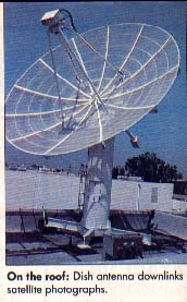
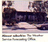
It looks like a suburban house until you see the 24-foot satellite dish antenna on the roof. This is the National Weather Service Forecasting Office, just off the freeway in Redwood City, California. Inside this unassuming building, an astonishing array of computers and electronic equipment helps meteorologists make weather forecasts for the Western United States, local TV stations and ships at sea.
"Everything the TV stations and newspapers get, they get from us," say weather service electronics technicians Bill Pettyplace, Dave Lindholm and Bob Levno. During a tour of the weather station, they gave us a glimpse of the side of meteorology that the public never sees.
The walls of the weather station are lined with maps--topographic maps, oceanic maps, local maps, world maps. A bumpersticker affixed to a door proclaims: "The ocean is a liquid asset." Computers are everywhere. The office literally hums with activity fmm banks of machines.
"And this," explains Pettyplace as we stand surrounded by blinking lights, printers, plotters and monitors, "is only the tip of very large iceberg." There are 280 Weather Service stations in the U.S., each loaded with an identical array of electronic paraphernalia. Only a handful, however, relay weather facsimile(WEFAX) satellite maps and photos.

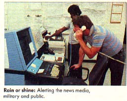
Our tour starts where the "product"--weather information -- ends. Just beyond the lobby, weather forecasters answer constantly ringing phones, peer over maps and distribute information to the news media and the public. But it all starts in that big dish on the roof.
MASSAGING THE MAPS
Those satellite photos in newspapers and on TV might mislead you into believing the earth already has a map deeply etched into its surface. Cloud pattems often obscure the earth's land masses. So before we see them, satellite photographs are "massaged," as Levno puts it in technician's jargon. In other words, the computer draws a grid of longitude and latitude and a political map indicating state and national boundaries aligned precisely with the land masses on the photograph.
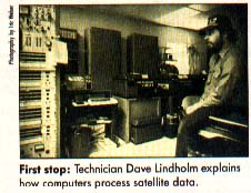
We visit yet another room of teleprinters, mainframe computers, IBM PC XT microcomputers, and huge, dual Data General Eclipse computers assembled especially for the weather service by Ford Aerospace. The photograph is recorded, divided up into four sectors, each quadrant small enough to fit on the plotter, and recorded again on computer tape drives. Another plotter creates contour maps of the jet stream and wind patterns.
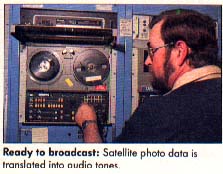
The images are then printed on wet, chemically-treated thermal paper. The paper printouts are saved for archival purposes for a period of 30 days. The technicians check the image on these large violet-colored printouts to "make sure we're sending out good product" Pettyplace says, before converting them hack to a digital form that can be stored on computer tape.
Pettyplace showed us an Alden Marine Fax plotter, the $2,000 plotter that ships use to decipher the maps.
"It essentially does what you'll be doing when you try to receive the satellite photos on your Atari computer screen," he says.
The information is stored on tape and an entire day's worth of satellite pictures are sent at once. The computer transmits the signal over telephone lines to a transmitter at the Coast Guard station in Point Reyes, a coastal town 75 miles north of Redwood City. WEFAX maps from this station are identified by the letters NMC across the top.
FINALLY, A FORECAST
And yet another room full of equipment, where meteorologists buzz around interpreting the satellite photos and making forecasts. Clouds swirl around the earth on huge video monitors. Pettyplace demonstrates weather service photos on a screen controlled with a trackball. He flips the ball, and zooms in again and again for a closer view of a coastline.
Twenty-four hours worth of these photos are spliced together into a video "loop," forming a l0-second show of clouds and atmospheric activity swirling around Earth. We watch a loop taken during the full moon. Pettyplace points out the moon's light reflecting off the Pacific Ocean at night.
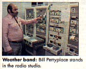
IBM microcomputers monitor the stations, deciphering hydrologic data, wind speed, air pressure and temperature. This information is then sent to repeaters. In yet another room, meteorologists record weather news reports to be broadcast over the local shortwave weather band.